Industry
In 2017, Lockheed Martin Space Systems Company and Curtin University signed an agreement confirming a joint Research and Development (R&D) partnership to establish a new Space Situational Awareness network in Australia. The partnership adapts meteorite tracking technology pioneered by Curtin University, whereby ground-based sensors will identify and track the trajectory of satellites and large space debris, helping to preserve the space environment over Australia by reducing the risk of collisions.
In 2018 the FireOPAL was announced: Lockheed Martin and Curtin University partnership develops world-class space tracking system
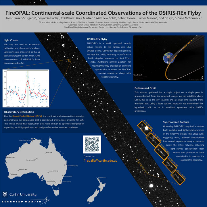
The FireOPAL program builds on six (6) years engineering heritage from the Desert Fireball Network – hardened sensors, capable of operating for 24 months in a harsh environment, fully autonomous, working together as a distributed network.
For satellite tracking, we get high precision from inexpensive optical systems simply by triangulating observations, rather than using an expensive telescope from a single viewpoint. FireOPAL systems are built to process all imagery in real time, delivering data from each observatory to a central server every few seconds for triangulation. Orbital predictions match ‘future’ FireOPAL observations to within 1 pixel, 24 hr later. Over a six (6) week period our trial system determined 6300 precise orbits for >1000 objects.
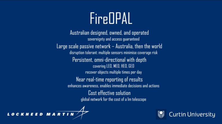
Key aspects of the FireOPAL system:
- Australian designed, owned and operated – sovereignty and access guaranteed;
- Large scale passive network (Australia, then the world) – large network = disruption tolerant with multiple sensors minimising coverage risk;
- Persistent, omni-directional with depth – image the same object multiple times per day;
- Near real time reporting of results – enhances awareness, enables immediate decisions and actions; and
- Cost effective solution – a global network for the cost of a 1m telescope.
Historically the model for SSA has involved using a small number of high value, high-resolution, narrow angle sensors, that deliver precise position data but image a given object rarely, combined with advanced modelling to try and accurately propagate orbits forward in time from infrequent observations. We take a very different approach by:
- Crushing the problem with very high data volumes
- Having so many sensors that we see the same object every few hours, which
- Removes the need to do advanced orbit propagation, because we never lose custody of an object.