PhD Projects & Scholarships
Consider applying for a PhD position at the School of Earth and Planetary Science at Curtin University, and join a diverse team of earth and planetary scientists and space systems engineers in the Space Science and Technology Centre.
We have multiple projects in the field of planetary science and space technology for candidates with backgrounds in astronomy, data science, geology, engineering, computer science, physics, maths. Scroll through the projects below, including projects with the Desert Fireball Network & large scale observational facilities; the Binar Space Program; and with our partners at the Curtin Institute of Radio Astronomy.
We are looking for a self-motivated PhD candidates with excellent computation, problem-solving and project management skills.
If you would like to work with us, and your ideal project is not listed below, please still enquire now to start an incredible research journey.
Merit based RTP scholarships for 2023 have now closed, but if one of the projects below interestes you, please contact the listed supervistor to discuss other avenues or entry in 2024.
Please contact the staff member listed with each project below to get started.

Projects using SSTC large scale observational facilities
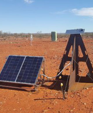
SSTC has pioneered the development of large networked facilities using hardened autonomous observatories. The Desert Fireball Network (DFN) has 50 autonomous stations across Australia. It has been observing ~2.5 million km2 of Australian skies since 2015. It provides a spatial context for meteorites – we can track a rock back to where it originated in the solar system, and forward to where it lands, for recovery by a field party. The database of >1400 meteoroid orbits is larger than the combined literature dataset for >70 years of observation, providing a unique window into the distribution of debris in the inner solar system. With 14 international partners, and facilitated by NASA, the project has recently expanded to a global facility. The Global Fireball Observatory (GFO) will cover x5 the observing area of the DFN, able to track debris entering our atmosphere 24 hours a day. These networks informed the development of a satellite tracking network – FireOPAL – with Lockheed Martin. Although designed for satellite observations, FireOPAL also happens to be a world-class astronomical transient observatory. The DFN, GFO, and FireOPAL are helping us answer fundamental questions in planetary science and astronomy. If you would like to be part of this team, and work with colleagues in universities around the world, at NASA, and in industry, read on.
Earth attack – the rate of impacts on Earth
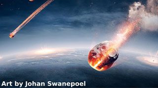
This project will use the Desert Fireball Network dataset of over 3 Petabytes of imagery to determine the impact rate of metre sized (and larger) impactors on Earth.
Read more
Whether looking for meteorite or tracking satellites, the Desert Fireball Network continuously scans large areas of the night sky, searching for meteorite-dropping fireballs.
But how much material is bombarding the Earth on a daily basis? The global data are well constrained for large (>10s m sized) objects, as well as the small, dusty material, but the cm-m size range is poorly known. The DFN dataset contains the largest and most complete record of the number, sizes, and orbits of material hitting our planet.
This project will use the DFN’s orbital database to answer the fundamental question: how often do we get impacted, and by what sizes?
This will place a critical constraint on the impact hazard (there is still an order-of magnitude variation in estimates of Tunguska-class impactors). These data can also be used to model the flux of material into the inner solar system in general. How much material might be expected on the Moon, or even Mars?
Project aims:
To use the Desert Fireball Network dataset of over 3 Petabytes of imagery to determine the impact rate of metre sized (and larger) impactors on Earth.
Project objectives are:
- Use a suite of observational data to determine the masses of incoming objects.
- Determine the flux of incoming objects, taking into account observational biases.
Surprisingly, we have a poor understanding of the impact rate in the larger, cm–10m size range of impactors on Earth. These bodies are still too small for telescopes to spot easily in near Earth space, and yet are still able to cause significant damages and casualties. The result of this project will have significant implications for space situational awareness studies and planetary defence.
Curtin University scholarship page for more information. Please contact Ellie Sansom to express your interest and apply.
From Observation to Mitigation: Leveraging LSST, the Global Fireball Observatory, and DREAMS to Prepare for Asteroid Impacts
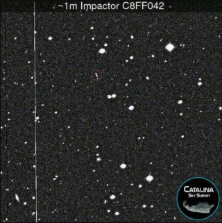
This PhD project aims to advance our understanding of the asteroid population and its potential impact on Earth using both the Vera Rubin Observatory (Legacy Survey of Space and Time – LSST) and the Global Fireball Observatory to detect and track potentially hazardous asteroids.
Read more
The threat of asteroid impacts on Earth necessitates the detection and tracking of potentially hazardous asteroids to develop effective mitigation strategies. This PhD project aims to explore the combined use of the Vera Rubin Observatory (Legacy Survey of Space and Time – LSST) and the Global Fireball Observatory for identifying asteroids impacting the Earth. The upcoming Australian Dynamic REd All-sky Monitoring Survey (DREAMS)’s high-cadence near-infrared observations will open a new parameter space on the asteroid population. With proprietary access to these three world class facilities, the candidate for this project will be in a unique position to push our knowledge of asteroids in our Solar System, and specifically the ones that can threaten the Earth.
The main aim of this PhD project is to advance our understanding of the asteroid population and its potential impact on Earth by using LSST and fireball networks to detect and track potentially hazardous asteroids.
The secondary aim to to make use of cutting-edge data from the Australian DREAMS telescope infrared survey, a so far poorly explored parameter space for asteroid characterisation.
To achieve these aims, this PhD project will focus on the following objectives:
– Use LSST observations to detect and track potentially hazardous asteroids, and to study their orbits, sizes, shapes, and compositions.
– Develop and test new algorithms and software tools for combining LSST and Global Fireball Observatory observations to improve our understanding of the asteroid impacting population on Earth.
– Process the DREAMS infrared telescope data to retrieve asteroids, generate an observation catalogue, and exploit the catalogue to derive physical properties of asteroids.
This PhD project has significant scientific and practical significance. Scientifically, it will advance our understanding of the asteroid population and its potential impact on Earth, and it will contribute to efforts to protect Earth from potential asteroid impacts. Practically, it will develop and test new algorithms and software tools for analysing LSST and DREAMS data, which can be used by astronomers and planetary defence experts to detect and track potentially hazardous asteroids, and to develop and implement mitigation strategies. Overall, this project will contribute to the ongoing efforts to study asteroids and their potential impact on Earth, and to protect our planet from potential catastrophic events.
Curtin University scholarship page for more information. Please contact Hadrien Devillepoix to express your interest and apply.
Meteorite Search and Recovery with Machine Learning
This project will focus on machine learning abilities to support new terrains and new detection techniques to recover fresh meteorites from the DFN. There will also be the opportunity for the applicant to investigate applied uses of this aerial anomaly-detection technology, such as search and rescue or environmental monitoring.
Read more
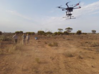
The Desert Fireball Network (DFN), operated by Curtin consists of a large array of astronomical cameras in the outback to recover fresh meteorites with orbits, by observing incoming meteors, and then searching for the fallen rock. Searching for meteorite falls in the remote outback is a costly activity, traditionally done with teams of people camped on site, searching the area on foot. Recently SSTC has developed a drone-based approach, using machine learning to identify meteorites in aerial imagery, with great success, and recovered multiple meteorites using a UAV. This project will build on this success, by extending the drone approach to new terrains and new meteorites, and investigating further applications of this technology.
This project will focus enhancing its capability and the system’s machine learning abilities to support new terrains and new detection techniques by developing and deploying the drone in the field, and as needed working to recover fresh meteorites from the DFN. There will also be the opportunity for the applicant to investigate applied uses of this aerial anomaly-detection technology, such as search and rescue or environmental monitoring.
This technology is new, and one objective is to democratise the tools, such that scientists and collaborators can also use it without specialist knowledge. The Desert Fireball Network is a highly active research environment, with multiple meteorites under investigation and study, and the drone based searching is an integral part of the team.
This project will contribute to Desert Fireball Network, the largest single dataset of incoming asteroidal material in the world. This unique facility is managed here at Curtin with the support of the Pawsey Supercomputing Centre. The DFN is one of the world leaders in the recovery of fresh meteorites with orbits, that are a highly valuable scientific resource.
Curtin University scholarship page for more information. Please contact Martin Towner to express your interest and apply.
Hazardous asteroids – Strength of Interplanetary Material
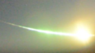
This project will look at the breakup of meteoroids in our atmosphere to calculate the bulk strengths of these objects, be it by seismic, infrasound or photometry.
Read more
Recent space missions to asteroids have gathered detailed information not just on the composition of these bodies, but also on their material properties – e.g. their strength, and whether they are a rubble pile or a single monolithic rock. But we know very little about the strength of small objects in the metre to 10s metre class.
This project will look at the breakup of meteoroids in our atmosphere to calculate the bulk strengths of these objects, be it by seismic, infrasound or photometry. It will also look at the origins of this material to determine if there is a correlation between strengths and any specific orbits or regions of the Solar System, or specific asteroids and their families.
The results will inform our understanding of the asteroid hazard (do small objects all generate airburst ‘Tunguska-like’ explosions), the lifetime of debris in the inner Solar System, and how we date the ages of planetary surfaces.

Characterising the habitability and of Mars throughout time using layered ejecta craters and multi-sensor satellite data
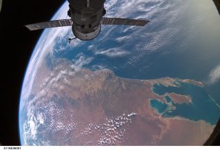
This research project aims to map the extent of the habitable regions of Mars throughout time using water/ice related impact morphologies, and identify regions where potential habitable environments may have persisted near to the surface, or for long periods of time. It will also develop new algorithms and satellite data products using machine learning based multi-sensor fusion algorithms to combine the products from different sensors on different satellites.
Contact:
Dr Eriita Jones
Read more
Overview: The extent of habitable conditions on other planets in the solar system – in particular, the existence of water environments – is a fundamental question for planetary exploration, guiding NASA’s current and planned Mars Sample Return missions and future human exploration. Mars is now known to have hosted localized, short duration liquid water environments at its surface and shallow subsurface, with potentially extensive liquid water environments deep in its crust, however the duration, depths and geographic distribution of these environments are still poorly known, as are their potential habitability. Identifying locations where water and conditions that could potentially support life have occurred near the surface of Mars, or have persisted for significant periods of time, are of high importance: not just for their scientific significance in understanding the potential implications for biology, but also for identifying shallow subsurface water resources that could be accessed by crewed missions. Secondly, there is a diversity of satellite sensors gathering data across the electromagnetic spectrum, at differing spatial, spectral, and temporal resolutions. There is a compelling need to combine the data from different sensors to generate new products that have optimised spectral and spatial resolution and mitigate the limitations inherent to any one single sensor.
Aims: The primary aim of the research project is to map the extent of the habitable regions of Mars throughout time using water/ice related impact morphologies, and identify regions where potential habitable environments may have persisted near to the surface, or for long periods of time. The secondary aim is to develop new algorithms and satellite data products using machine learning based multi-sensor fusion algorithms to combine the products from different sensors on different satellites thereby filling data acquisition gaps.
Objectives: The objectives of this work are to quantify the extent of potentially habitable environments (PHEs) within the crust of Mars, where a habitable environment can be considered most broadly as one which supports: liquid water of varying plausible chemistries (brines), within a range of temperatures appropriate for terrestrial microorganisms. The existence of habitable conditions will be probed using a subset of impact craters that likely to have formed from the presence of water/ice in the subsurface. A range of satellite datasets will be used by the candidate to constrain the depth to, water concentration, salinity of, and age of the PHE, including: impact crater morphometry, mineralogy, rock and grain-sizes and their distribution. The remote sensing datasets used will include: high resolution camera imagery, elevation, thermal inertia, and multi-and hyperspectral data across the visible, shortwave infrared and thermal wavelengths from a range of sensors and satellites. The candidate will take existing machine learning image fusion algorithms, and further develop them to the unique application of infilling the particular temporal, spectral and spatial gaps of Mars satellite sensors to generate novel satellite data products at enhanced spectral and spatial resolutions than what is currently available. The output of the work will be maps of high priority PHE that occur near-surface, or zones where PHEs cluster and or conditions of habitability are likely to have persisted for a significant period of time.
Significance: The outcomes of this work are significant for enhancing the knowledge capacity of past, present, current and future space-based datasets, through the development of innovative algorithmic tools specifically designed to address the wide gaps in satellite data coverage, thereby improving the potential knowledge and insights from future Australian’s sensors and contributing key new knowledge for both the Australian and the global space sector.
Curtin University scholarship page for more information including stipend rates and eligibility. Please contact Dr Eriita Jones to express your interest and apply.


Build the Future of Space with the Binar Space Program
Our whole program grew out of student research projects. We’re looking for PhD students to help us build the next generation of Australian small spacecraft and explore the solar system.
Distributed Fault-tolerant Small Spacecraft Architecture
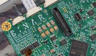
This project will investigate the benefits and limitations of a fault spacecraft architecture using a distributed systems approach leveraging standard communications and networking protocols used in commercial terrestrial fields (including computing, automotive, and the industrial Internet of Things) as well as modern network-enabled real time operating systems.
Read more
Overview: The Space Science and Technology Centre at Curtin University is building highly capable small spacecraft within its Binar Space Program. Our first spacecraft, Binar-1, which trialled our ultra-compact spacecraft platform was launched in October 2021, and we’re currently building the next three spacecraft, Binar-2, Binar-3 and Binar-4, for launch in the first half of 2024. With each iteration we are evolving our capability whilst retaining a highly compact platform which keeps around 70% of a 1U CubeSat available for mission payload. As we prepare for our flagship mission, Binar Prospector, which will travel to a low altitude orbit around the Moon and search for resources to enable the next era of space exploration, we are interested in exploring new ways to increase the reliability of small spacecraft via incorporating redundancy at the system level.
As small spacecraft are increasingly travelling beyond low Earth orbit, there is an increasing need to increase the fault tolerance to produce more reliable spacecraft, but this needs to be implemented without significantly increasing cost, mass and volume to retain the cost and timeline advantages of small spacecraft. This project aims to investigate ways to build small spacecraft with additional fault tolerance while minimising the added complexity to better inform the space systems architecture used on future Binar space missions.
Aims: The aims of the research project are to investigate the benefits and limitations of a fault spacecraft architecture using a distributed systems approach leveraging standard communications and networking protocols used in commercial terrestrial fields (including computing, automotive, and the industrial Internet of Things) as well as modern network-enabled real time operating systems.
Objectives: The objectives of the research are to develop a proof-of-concept fault tolerant distributed spacecraft architecture and compare the approach and performance with the traditional approaches (component hardening, component redundancy using voter circuits) via test and analysis for a variety of mission scenarios both in Earth orbit, and beyond. The trade-off between fault tolerance provided by system level redundancy and increased complexity viewed through the lens of mission risk will be a key focus of the work. Whilst this entire project can be successfully completed with ground testing alone, an additional aim is to also conduct some on-orbit testing of the approach.
An early step in the work may focus on developing and testing a proof-of-concept implementation using microcontroller or microprocessor based nodes (representing spacecraft subsystems) connected via an IoT communication protocol such as CoAP on an IP network over single pair ethernet, but the exact nature of this first proof-of-concept implementation will be determined by the successful applicant themselves.
Significance: The outcomes of this work will guide the future directions of the Binar spacecraft program which aims reduce the barriers to space activity and space exploration. The lessons learned will directly guide the development of future Binar spacecraft platforms, and in particular our flagship Binar Prospector Lunar mission.
The work will involve space system architecture design, distributed systems, embedded software development, embedded electronics hardware development and assembly, ground testing in relevant environments (thermal vacuum chamber, vibration testing), flight qualification, on orbit operations and publication.
Curtin University scholarship page for more information including stipend rates and eligibility. Please contact Dr Robert Howie to express your interest and apply.

Low Altitude Lunar Imaging
This project will investigate the trade space for low altitude (10-30 km) Lunar imaging systems considering a broad range of options including multiple camera, multi-band and computational imaging systems with the goal of maximising the scientific and programmatic benefits of the opportunity provided by this unique perspective.
Read more
Overview: The Space Science and Technology Centre at Curtin University is building highly capable small spacecraft within its Binar Space Program. Our first spacecraft, Binar-1, which trialled our ultra-compact spacecraft platform was launched in October 2021, and we’re currently building the next three spacecraft, Binar-2, Binar-3 and Binar-4, for launch in the first half of 2024. With each iteration we are evolving our capability whilst retaining a highly compact platform which keeps around 70% of a 1U CubeSat available for mission payload. As we prepare for our flagship mission, Binar Prospector, which will travel to a low altitude orbit around the Moon and search for resources to enable the next era of space exploration, we are interested in exploring new ways to increase the reliability of small spacecraft via incorporating redundancy at the system level.
In order to deliver high resolution magnetometry, Binar Prospector will regularly operate at lower altitudes than previous Lunar orbiters. This unique perspective of the Moon will present an opportunity to capture inspiring and scientifically valuable imagery.
Aims: The aims of the research project are to investigate the trade space for low altitude (10-30 km) Lunar imaging systems considering a broad range of options including multiple camera, multi-band and computational imaging systems with the goal of maximising the scientific and programmatic benefits of the opportunity provided by this unique perspective. Following the trade study, the project aims to develop, qualify and fly a prototype system to fly on a low Earth orbit pathfinder spacecraft to prove the critical systems ahead of the Lunar science mission.
A particular focus of the system will be on collecting high resolution imagery of possible future landing sites for robotic and human landings under NASA’s Moon to Mars Program. Current imagery is limited in spatial resolution and only available from an overhead perspective. Higher spatial resolution and oblique views will provide better insight into landing obstacles and allow mission designers to retire significant mission risk.
Objectives: In order to accomplish the aims, the first objective of this research project is to complete the trade study via analysis. The results of the trade study will be used to design an imaging system which will be ground tested, spaceflight qualified and then undergo integration testing with the pathfinder spacecraft platform. During the system design, the opportunities to capture inspiring imagery for STEM engagement with the general public will also be considered. Should the system successfully fly in Earth orbit, Earth observation data from the system will also be used to validate the system design.
Significance: The outcomes of this work will shape the design of the imaging system on the Binar prospector Lunar spacecraft and the type of scientifically valuable and inspiring imagery captured during the mission. If successful, the imaging system architecture will be reused on future Australian planetary missions to other destinations such as Mars or near Earth asteroids.
The imagery collected during the Lunar science mission with the imaging system designed during this project, could influence the direction of humanity’s space exploration by providing unique observations of potential landing sites for future human and robotic landing missions.
The work will involve trade studies by analysis, imaging system development, embedded electronics, computer vision, assembly, ground testing in relevant environments (thermal vacuum chamber, vibration testing), flight qualification, on-orbit operations and publication.
This project will present opportunities to build hardware and develop software that will fly in space and opportunities to engage with SSTC’s industry partners. The Space Science & Technology Centre (SSTC) is the largest planetary science group in the southern hemisphere comprising ≈40 researchers with expertise across the planetary sciences, including planetary geology, fireball physics, impact crater analysis and statistics, and Solar System formation. The candidate will be exposed to a wide range of support from all personnel at levels, including academic and professional support, and will enjoy collegiate support from their PhD peers.
Curtin University scholarship page for more information including stipend rates and eligibility. Please contact Prof. Phil Bland to express your interest and apply.
Low Cost Navigation for Small Lunar Missions
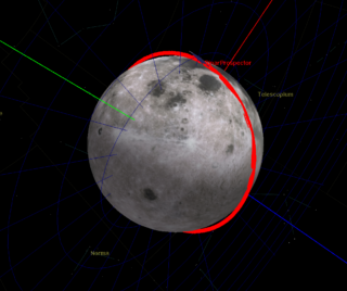
This project will investigate alternatives to traditional radiometric navigation and orbit determination for low altitude Lunar orbiting missions which could provide better navigation for science missions and open the door to a larger number of cost-effective small Lunar by reducing the reliance on scarce ground stations with navigation capabilities.
Read more
Overview: The Space Science and Technology Centre at Curtin University is building highly capable small spacecraft within its Binar Space Program. Our first spacecraft, Binar-1, which trialled our ultra-compact spacecraft platform was launched in October 2021, and we’re currently building the next three spacecraft, Binar-2, Binar-3 and Binar-4, for launch in the first half of 2024. This will be followed by Binar Prospector Pathfinder in low Earth orbit and Binar Prospector science mission in low Lunar orbit.
The future Binar Prospector spacecraft are in a uniquely low orbit, close to the lunar surface. There is the opportunity to equip these (and other) spacecraft with the capability to take data from scientific sensors, most notably images, attitude control sensor results and illumination information, and fuse this data with predictions, to improve orbit determination and control. This outcome will further generate new scientific results by enhancing the spatial precision of the mission’s primary dataset: Lunar magnetometry.
Aims: The aim of this research project is to investigate the viability of a sensor fusion based approach to either real-time on board navigation or offline orbit reconstruction for future small (<50 kg) Lunar orbiters. If successful, this approach will lead to enhancements in scientific return, and improved mission capabilities. The results of this work will be applicability to other small and lower-cost Lunar obiters beyond the Binar Space Program.
Objectives: In order to determine the viability of the approach, the research will start by building an orbit determination model based on traditional ground-segment based (range and range rate) orbit determination. The investigation will then focus on the suite of additional data sources available (including illumination, optical imagers, horizon sensors, star trackers) and modelling the additional certainty they can add to the orbital and position estimates, either in an online real-time implementation for navigation or an offline after the fact implementation for improved orbit reconstruction for science data.
To build and demonstrate system for improving scientific capabilities of small satellites in Earth and Moon, by improving navigation capabilities, to a) reduce team costs, b) reduce complexity of ground-spacecraft control loop, c) enable more science by better positional awareness, control and capability.
Significance: Ground stations capable of conducting orbit determination and communications for Lunar spacecraft are tightly constrained and highly specialised resource and will be a significant bottleneck for robotic planetary missions to the Moon and beyond in the near to medium term. The operations costs associated with the ground segment time required for accurate orbit reconstruction or to operate at low altitudes are also a significant fraction of a mission budget.
Navigation or orbit reconstruction approaches that do not rely on orbit determination via the ground segment would unlock this bottleneck to allow humanity to operate more space exploration missions beyond Earth orbit which will be important as the Moon is now within reach for small spacecraft developers.
Curtin University scholarship page for more information including stipend rates and eligibility. Please contact Professor Phil Bland to express your interest and apply.

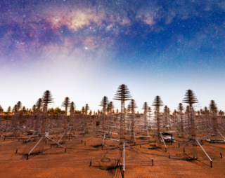
Projects with our collaborators at the Curtin Institute for Radio Astronomy
Curtin Institute of Radio Astronomy is also offering various Phd Scholarships in the field of Astronomy, Engineering and Science. Check them out on the CIRA website.
List of Projects - see CIRA website for more details and how to apply.
Designing Massive Phased Antenna Arrays for Future Wireless Communication Systems
Developing novel algorithms and approaches for beamforming and pulsar searching in the SKA era
Hunting black holes and neutron stars in star clusters
Detecting Cosmic Web in emission using the MAGPI Survey
Monster Black Holes Across Cosmic Time
Novel transient radio sources in MA surveys
Understanding the host galaxies of fast radio bursts
All-sky real-time searches for low-frequency Fast Radio Bursts
